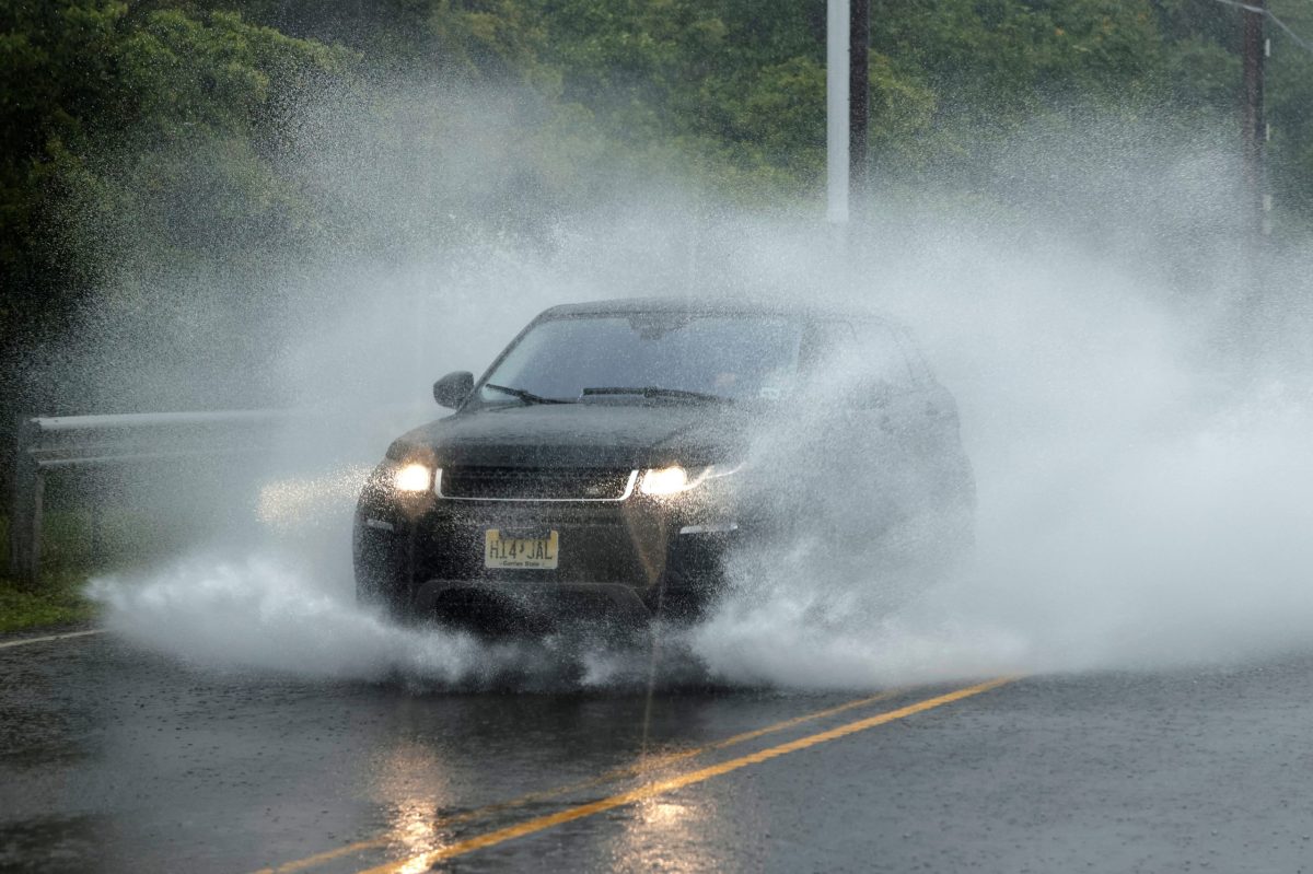
Get ready to experience very heavy rain and high winds in New York City on Tuesday as Tropical Storm Isaias advances up the Eastern Seaboard.
The five boroughs are under a tropical storm warning, which means that conditions for a storm within the next 36 hours are imminent. There’s also a flash flood watch and a wind advisory.
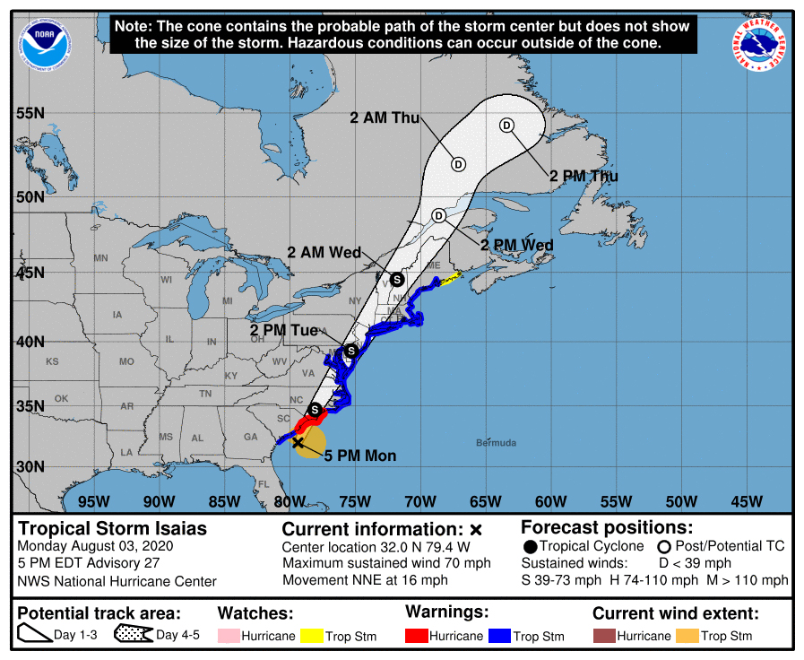
Isaias, which strengthened into a hurricane but weakened back into a tropical storm, is currently churning toward the Carolinas, where he’s expected to make landfall as a Category 1 hurricane. The storm is then expected to take the overland route toward our area, weakening back into a tropical storm along the way.
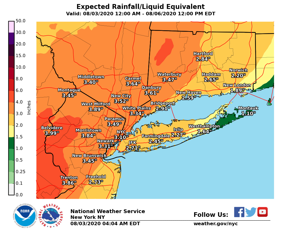
The city is expected to begin feeling Tropical Storm Isaias’ wind and rain on Tuesday morning. The National Weather Service forecasts that the five boroughs could see between 2 and 4 inches of rain; some isolated spots could experience rainfall totals of up to 6 inches.
Tropical storms have sustained winds of between 39 and 74 mph, and strong winds are forecast as Isaias approaches New York City. Peak gusts during the storm could be as strong as between 58 and 73 mph, escalating the threat of downed power lines and trees.
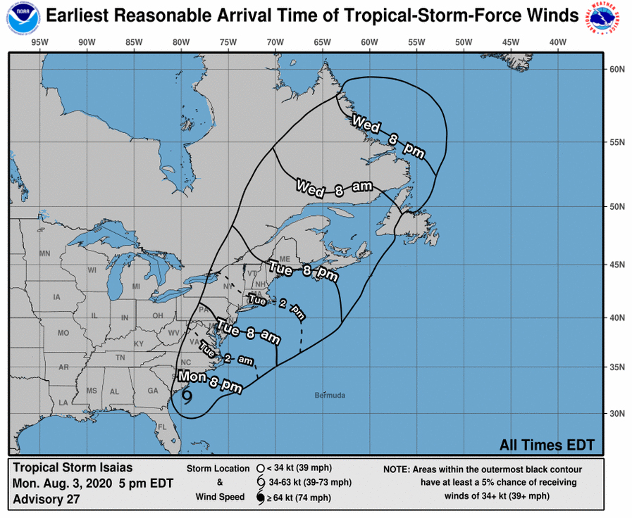
Isaias’ storm center is currently forecast to travel over land upon making landfall, and the storm will weaken as it approaches. It’s projected to enter the New York City area sometime between Tuesday afternoon and evening.
Nevertheless, the National Weather Service indicated a potential for some minor coastal flooding associated with the storm; there’s a potential storm surge of up to a foot above ground. A coastal flood watch is in effect for Tuesday from 8 p.m. to 2 a.m. the next morning.
Surf heights at the beaches could reach up to 11 feet during the height of the storm on Tuesday. Bathers heading to the shore Monday should guard themselves against strong rip currents.
Already, the city’s Emergency Management department has installed temporary reinforcements — such as sandbags and inflatable berms — in low-lying South Street Seaport to guard against potential flooding. Other measures are also being implemented to guard against flooding in low-lying spots, such as catch basin cleanings.
Con Edison advised customers in a text alert that it is ready to handle any power disruptions experienced during the storm. Customers are urged to call 800-75-CONED or visit coned.com to report a power outage.
City beaches are closed tomorrow due to the impending storm. The 9/11 Memorial also closed Tuesday, and the Yankees have postponed their scheduled home game against the Philadelphia Phillies.
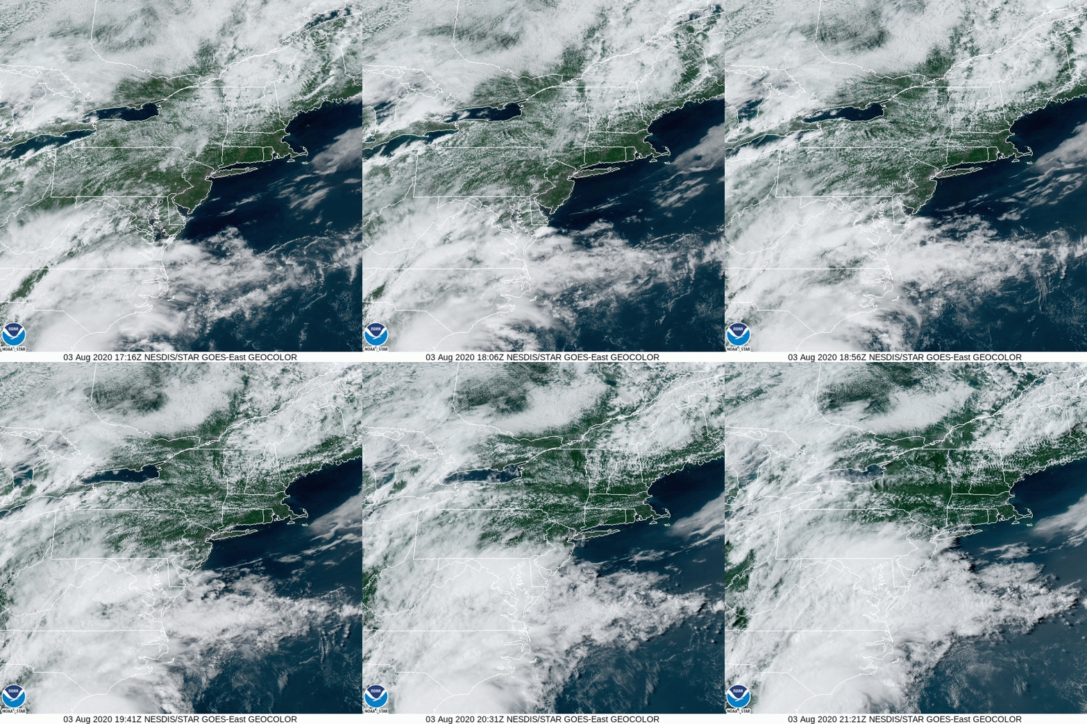
This is the second time this summer New York City finds itself in the path of a tropical storm. Back on July 10, Tropical Storm Fay dumped two inches of rain and spread heavy winds across the tri-state area, causing isolated flooding and power outages.
Check with amNY.com later for additional developments on Isaias.


