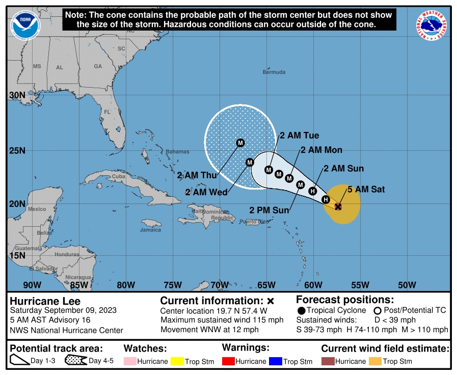
Hurricane Lee weakened over the past 24 hours from a Category 5 monster to a moderate Category 3 storm, but it remains unclear as to whether he will take aim New York or any other part of the Eastern Seaboard sometime next week.
The storm is currently churning about 385 miles east-northeast of the Leeward Islands, with peak winds of 115 mph in the eye recorded as of 5 a.m. Sept. 9, according to the National Hurricane Center. Lee is forecast to crawl in a west-northwest direction over the open water over the next week, missing the Leeward Islands as well as Hispaniola and Puerto Rico; nonetheless, the islands are expected to dangerous surf over the next few days.
The cone of uncertainty — which forecasters use to track a hurricane’s possible movements — has the center of Lee situated well north of the Dominican Republic, but taking a turn to the north by 2 a.m. Thursday, Sept. 13. Where Lee goes from there remains a mystery.
“It is way too soon to know what level of impacts, if any, Lee might have along the U.S. East Coast, Atlantic Canada or Bermuda late next week, particularly since the hurricane is expected to slow down considerably over the southwestern Atlantic,” the National Hurricane Center wrote in its Sept. 9 advisory.
What is certain, the agency noted, is that starting as early as Sunday, Sept. 10, most of the U.S. East Coast will begin to see “dangerous surf and rip currents” connected to Lee. Those will likely intensify as the storm inches further on its projected course.

New York City beaches are closed after Sept. 10, so swimming will be prohibited on the shore after that date, as no lifeguards will be on duty. Nevertheless, areas on the shore could experience coastal flooding and beach erosion resulting from rougher surf.
Hurricanes are fueled by warm water, and Lee rapidly intensified Thursday into Friday in areas of the Atlantic where ocean temperatures are above 80 degrees. AccuWeather forecasters project it will be a Category 4 (maximum winds 130-156 mph) by early Thursday, as it will travel over cooler waters while heading to the west-northwest.
Lee is the most intense Atlantic hurricane since Dorian in 2019, according to AccuWeather. Dorian’s peak winds topped out at an obscene 185 mph before it made landfall in the Bahamas.
In some ways, Lee is taking a similar path to Hurricane Gloria, the most recent hurricane to make landfall in New York. Gloria struck the Carolinas and New York in September 1985; by the time she made landfall on Long Island, she was a fast-moving Category 1 hurricane with maximum sustained winds of about 85 mph.
While New York City was spared her brunt, areas of Long Island suffered heavy wind damage and power outages from toppled utility lines.
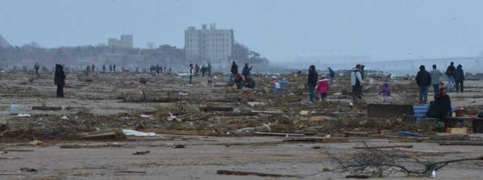
Other former hurricanes have made landfall in New York as weakened tropical storms, the most recent of which was Irene in August 2011. The following year, however, the New York City area felt the wrath of Superstorm Sandy in October 2012 ; while the storm’s center made landfall in Atlantic City, NJ, Sandy sent a massive surge northward that devastated coastal areas of the Big Apple, killing dozens and wreaking billions of dollars in damage.
Updated on Sept. 9 at 10:05 a.m.


