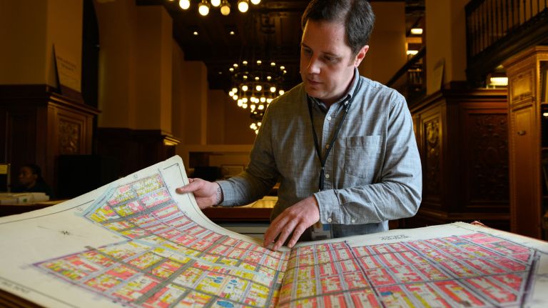
Hoisting a giant book, several feet tall, onto a wooden table inside the New York Public Library, Ian Fowler begins flipping through yellowed and frayed pages.
Fowler, the maps curator and a geospatial librarian at the Stephen A. Schwarzman Building on Fifth Avenue, carefully traces block after block until he finds the one he is looking for. The maps are part of the New York Fire Insurance Map produced in 1915. The century-old document is only one of the 500,000 maps and atlases in the library’s maps division.
"Maps are everywhere, because maps are extremely important," he said. "I refer to them as stained glass windows, it’s a very easy way to convey information without having to read a lot of text."
Contained inside the midtown building and open for the public to peruse, the maps range from political propaganda to those showing countries and empires that no longer exist. They range in size from a few inches to several square feet, and date back as far as the 15th Century (Fowler said the earliest modern map the library has shows Palestine in 1475).
In total, he said the library has about 800,000 maps spread out among different divisions, including manuscripts and rare books or prints.
"People already have a mental idea of geography, of place. So you can use maps … for a variety of purposes and to depict a variety of the peoples who inhabit those places," he said.
Mitchell Map, 1755
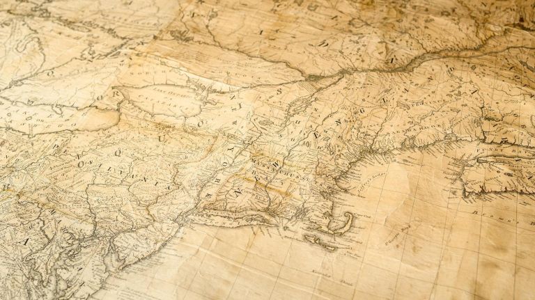
Considered the most important map in American history, Fowler said the museum has a few copies of this giant map. The map was produced in 1755 for King George III to see all the land he had just gained from the French following the end of the French and Indian War. But Fowler said that after the American Revolution, the same map was ironically used to divide the continent between American and British territories.
"So the map that King George III had made to aggrandize his holdings of land is the one that’s used to take half of them away," he said.
Propaganda Map, 1941
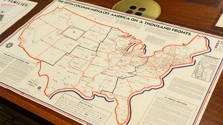
This map from the year the U.S. entered World War II aimed to amalgamate Nazi-ism, fascism and communism "as one unified effort to destroy America from the inside," Fowler said. The map had definitions of each group and what the user could do to fight them.
"They’re really trying to [instill] fear through ignorance in showing that they’re everywhere," Fowler said.
One of the mapmakers, Joseph P. Kamp, was later convicted of trying to distribute anti-American propaganda to support desertion.
Soviet Union Forced Labor Camp Map, 1951
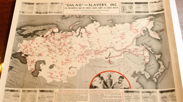
The post-WWII map was produced by the American Federation of Labor, created from work done by Polish officers from 1945 to 1947.
"This was a challenge to UNESCO and to world governments to take action against the gulags and against slave labor in the Soviet Union," Fowler said.
Text on the bottom of the map offered a $1,000 reward for anyone who could authentically dispute any of the information on it.
"And it was overwhelmingly well received," Fowler added. "There was an article in Time magazine that reproduced the map, and it really worked to enhance knowledge."
World Map, 1684
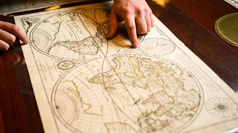
This 17th Century map from Paris is believed to be the first created by a woman. While Fowler said women were involved in all parts of the map trade, they rarely had their own names put on a map. This particular map was made by A.M. Angelique D.V., the widow of Pierre Duval, the geographer to the king of France. The map, which featured California drawn as its own island and a land mass drawn where yet-to-be-discovered Antarctica is, "carried over from a 2nd Century AD idea that because they knew there was a northern continent, there had to be a southern continent to balance the earth."
German World Map, 1513
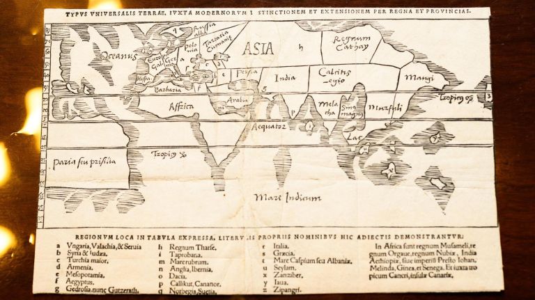
The rare 16th Century map, created on cotton paper, showed the New World, complete with a North America that was "barely on the map. But this was 1513, this is what was known then," Fowler said. He added that when the map was made, some people still believed that North America may have connected to the eastern part of Asia.
World Map playing card, 1678
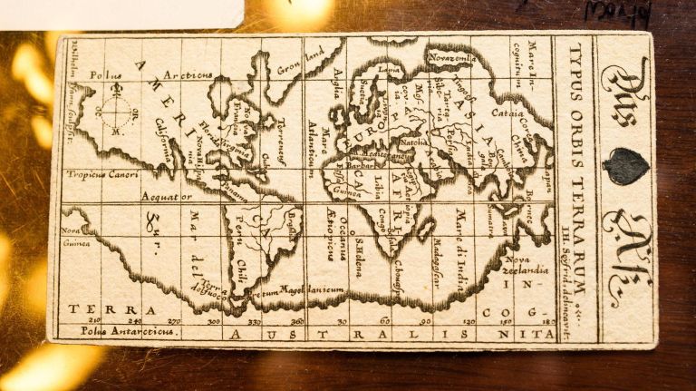
The card, the ace of spades, was part of a set that highlighted each continent as a different suit in the deck. Each card contained different countries within each suit; the suits were handwritten and the maps printed. While at one time the elaborate card had a golden edge, Fowler said it has faded over time and through use.
Ottoman Empire Map, 1803
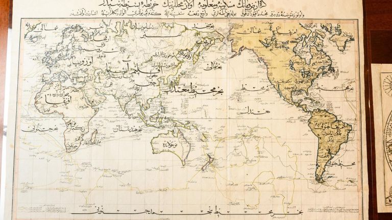
This was the first world map made by the Ottoman Empire, and was written in Ottoman Turkish. Fowler said very few of these maps exist: Only 50 copies were ever produced and the majority were believed to be destroyed in a warehouse fire. The map was a copy of a British map, and showed the voyages of James Cook, a British captain and explorer.
Norman Mailer and Jimmy Breslin Campaign Map
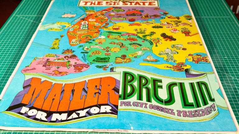
The funky, colorful map and poster detailed several New York City neighborhoods, calling it the 51st State. The campaign poster, created for their 1969 Democratic mayoral primary election, was a nod to the Beatles and even featured a reference to the "Yellow Submarine" with a similar-looking figure in the water off the coast of the Rockaways.
"They thought that New York politics was so corrupt and so stalled and so stymied, that at least this way they could use the cache that Mailer, Breslin, and (Gloria) Steinem had to actually get politicians to hopefully talk about the issues that affected real New Yorkers and not just the millionaires," Fowler said.
